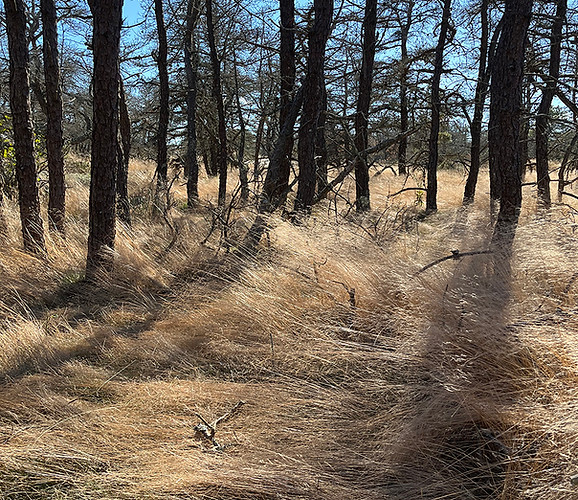
Napeague, Long Island.
Photograph by Tanya Marcuse
Napeague sits at the end of Long Island, a thin strip of land that separates the Peconic Estuary from the Atlantic Ocean. The biodiverse area is composed of wetlands, salt marshes, pine and oak forests, and dunes. Development, climate change, and diseases threaten these unique habitats, prompting ONE LANDSCAPE to promote cohesive stewardship of this area.
Our work in Napeague includes artist residencies, community walks and other events. Our pilot initiative, The Beach Hampton Nature Group, is focused on the neighborhood of Beach Hampton, the largest residential community within the study area. The area is threatened by the installation of more domesticated, less diverse landscapes.
Group activities include an ecological inventory of the primary dune, back dune, wetland, pine and oak forest threaded throughout this community. Future activities will include community wildlife watches and the Green Squad, an environmental educational program for kids in the community.


Mapping Napeague
Image by Margie Ruddick
Napeague is the low point in the south fork, where historically, during floods, the Peconic Estuary would have flowed directly into the Atlantic Ocean. While the development of the railroad in the late 19th century created a berm, cutting this intermittent exchange off, the area is predominantly lower and historically less developed for that reason.
To understand Napeaugue as a site, ONE LANDSCAPE created a series of maps that examine topography, land ownership, and habitat. The work highlights the way a continuous and changing ecosystem is divided. ONE LANDSCAPE hopes to bring the relevant groups together to see this area as a whole.


